Atama Vis
Aerial Monitoring & AI Disease Detection
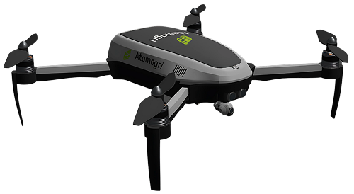
See Your Farm From Above
Atama Vis combines advanced drone technology with artificial intelligence to provide comprehensive aerial monitoring of your crops. Detect diseases early, assess crop health, and make data-driven decisions with precision agriculture.
Our drone system integrates seamlessly with the Atama Sense dashboard, providing a complete picture of your farm from ground sensors to aerial imagery.
Key Features
Advanced aerial monitoring capabilities powered by AI and precision sensors.
Aerial Imaging
High-resolution aerial photography for comprehensive crop monitoring and mapping.
AI Disease Detection
Machine learning algorithms identify plant diseases early, before visible symptoms appear.
Automated Missions
Pre-programmed flight paths for consistent coverage and efficient field surveys.
Detailed Reports
Generate comprehensive field health reports with actionable insights and recommendations.
NDVI Analysis
Normalized Difference Vegetation Index for crop health assessment
Thermal Imaging
Detect water stress and irrigation issues through thermal cameras
Multispectral Analysis
Capture data across multiple wavelengths for detailed analysis
Plant Counting
Automated plant counting for accurate yield prediction
Weed Detection
Identify weed infestations for targeted treatment
3D Mapping
Create detailed 3D terrain models of your fields
AI-Powered Analysis
Our advanced machine learning models analyze aerial imagery to detect issues before they become visible to the naked eye. From disease detection to yield prediction, Atama Vis provides actionable insights.
- 95%+ accuracy in disease detection
- Real-time processing and alerts
- Historical trend analysis
Technical Specifications
Up to 45 minutes
10+ km
48MP RGB + Multispectral
RTK: 1cm + 1ppm
Up to 12 m/s
Up to 200 hectares/flight